


Voting District 23, Surry County, North Carolina
About
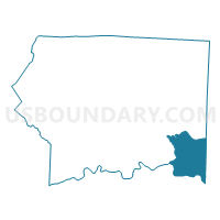
Outline

Summary
| Unique Area Identifier | 641458 |
| Name | Voting District 23 |
| County | Surry County |
| State | North Carolina |
| Area (square miles) | 29.19 |
| Land Area (square miles) | 28.75 |
| Water Area (square miles) | 0.44 |
| % of Land Area | 98.49 |
| % of Water Area | 1.51 |
| Latitude of the Internal Point | 36.30480700 |
| Longtitude of the Internal Point | -80.49020940 |
Maps


Graphs
Select a template below for downloading or customizing gragh for Voting District 23, Surry County, North Carolina


Neighbors
Neighoring Voting District (by Name) Neighboring Voting District on the Map
- Voting District 09, Stokes County, NC
- Voting District 091, Forsyth County, NC
- Voting District 21, Surry County, NC
- Voting District 24, Surry County, NC
- Voting District EBND, Yadkin County, NC
- Voting District NFAL, Yadkin County, NC
Top 10 Neighboring County Subdivision (by Population) Neighboring County Subdivision on the Map
- Yadkin township, Stokes County, NC (21,834)
- Old Richmond township, Forsyth County, NC (5,236)
- Pilot township, Surry County, NC (4,020)
- East Bend township, Yadkin County, NC (3,489)
- Shoals township, Surry County, NC (2,032)
- North Fall Creek township, Yadkin County, NC (1,515)
- Siloam township, Surry County, NC (1,148)
Top 10 Neighboring Unified School District (by Population) Neighboring Unified School District on the Map
- Forsyth County Schools, NC (350,670)
- Surry County Schools, NC (56,264)
- Stokes County Schools, NC (47,401)
- Yadkin County Schools, NC (38,406)
Top 10 Neighboring State Legislative District Lower Chamber (by Population) Neighboring State Legislative District Lower Chamber on the Map
- State House District 91, NC (74,449)
- State House District 92, NC (68,165)
- State House District 74, NC (67,946)
Top 10 Neighboring State Legislative District Upper Chamber (by Population) Neighboring State Legislative District Upper Chamber on the Map
Top 10 Neighboring 111th Congressional District (by Population) Neighboring 111th Congressional District on the Map
Top 10 Neighboring Census Tract (by Population) Neighboring Census Tract on the Map
- Census Tract 501.01, Yadkin County, NC (5,600)
- Census Tract 704, Stokes County, NC (5,337)
- Census Tract 28.01, Forsyth County, NC (4,236)
- Census Tract 501.02, Yadkin County, NC (4,066)
- Census Tract 9311.02, Surry County, NC (3,728)
- Census Tract 9312, Surry County, NC (3,711)
- Census Tract 9311.03, Surry County, NC (1,846)